Understanding the Geography of Scandinavia: Physical Features and Landscape Diversity
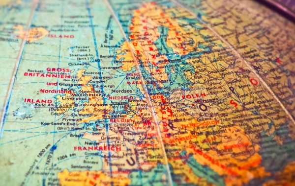
The geography of Scandinavia is a fascinating study of contrasts and natural beauty, spanning a region of Northern Europe that is both rugged and stunningly picturesque. At its core, the map of Scandinavia traditionally includes Norway, Sweden, and Denmark. These countries share a distinctive landscape marked by towering mountain ranges, deep fjords, expansive forests, and thousands of lakes that shape not only their environment but also their cultures and economies.
Norway’s geography is dominated by its dramatic coastline, carved by glacial activity that formed some of the world’s most famous fjords. From the Sognefjord, the longest and deepest fjord, to the narrow, steep-edged Nærøyfjord, these waterways provide critical habitats as well as popular locations for exploration and tourism. Inland, Norway’s terrain rises sharply to the Scandinavian Mountains, which form a natural border between Norway and Sweden, featuring peaks such as Galdhøpiggen, the highest in Northern Europe.
Sweden, in contrast, presents a more moderate topography but equally vast forested regions. The country boasts thousands of pristine lakes, including Vänern and Vättern, the largest and second-largest lakes, respectively, in Scandinavia. These freshwater bodies, along with extensive boreal forests, define much of Sweden’s landscape, contributing to a thriving forestry industry and providing key outdoor recreational areas. The Swedish archipelago along the Baltic Sea adds intricate coastal geography to the national map, rich in islands and biodiversity.
Denmark, positioned on the Jutland Peninsula and numerous islands, contrasts sharply with the mountainous nature of Norway and Sweden. It is primarily flat, composed of rolling plains and sandy coastlines. Denmark’s geography plays a crucial role in its dense population and agricultural productivity, with fertile soils supporting extensive farming. The country’s islands and peninsulas also contribute to its intricate maritime culture, with shipping and fishing remaining vital economic sectors.
The topography of Scandinavia is further nuanced when considering the potential inclusion of Finland and Iceland. Though Finland’s geography diverges slightly, characterized by vast lakes – over 187,000 of them – and dense boreal forests, some geologists and economists find merit in including it within the broader Scandinavian context due to shared climatic conditions and economic ties. Iceland, located farther northwest in the Arctic Circle, offers a volcanic landscape with geysers, glaciers, and rugged coastlines, expanding the geographical diversity associated with the Scandinavian region.
Studying the map of Scandinavia thus provides a layered understanding of Europe’s northern geography, where climate, terrain, and water bodies intricately connect to shape the region’s identity. Whether it’s the fjords of Norway, Sweden’s inland lakes, Denmark’s coastal plains, or Finland’s forested expanse, the physical geography establishes the foundation for appreciating the cultural and economic narratives that arise from these key locations.
Political Boundaries and Key Locations on the Map of Scandinavia
The political geography of Scandinavia intertwines closely with its physical features, shaping the identities and administrative divisions of Norway, Sweden, and Denmark. On a map, these countries form a contiguous region with clearly defined borders, yet each boasts unique internal divisions and landmarks crucial for understanding regional governance and connectivity.
Norway’s territory covers approximately 385,000 square kilometers, with Oslo as its capital located at the southern tip near the Oslofjord. Norwegian counties, known as “fylker,” include notable regions such as Vestland, home to Bergen and key fjords, and Troms og Finnmark in the far north, bordering Finland and Russia. These regions host diverse populations living alongside vast wilderness areas, balancing urban development with nature conservation. Major ports such as Stavanger and Trondheim enhance Norway’s role as a maritime hub, crucial for shipping and offshore oil industries.
Sweden, larger in size with an area over 450,000 square kilometers, centralizes governance in Stockholm, on the east coast of the country. The kingdom is divided into counties (län) like Västra Götaland, known for the city of Gothenburg, Sweden’s second-largest metropolis with robust industrial and cultural significance. Northern counties like Norrbotten feature rugged terrain and rare Arctic landscapes. The map reveals how the urban centers stack primarily in the south, while the north remains sparsely populated but rich in natural resources such as timber and minerals.
Denmark, though the smallest geographically, remains politically pivotal within Scandinavia. The capital city, Copenhagen, stands on the island of Zealand and draws significant attention due to its historical and economic influence. Denmark’s administrative regions include the North Jutland Region and the Capital Region of Denmark, emphasizing a balance of mainland and island jurisdictions. Its strategic position near continental Europe facilitates its active participation in EU policies and Nordic cooperation.
Some debates persist about the definition of Scandinavia within political contexts, especially concerning Finland and Iceland. Finland shares a lengthy eastern border with Russia and is counted by some as part of the Scandic sphere due to cultural and economic ties, though it’s more broadly included in the term “Nordic countries.” Iceland remains geographically isolated but culturally linked through language and history, reinforcing its membership in the Nordic cooperative network.
Understanding these political boundaries on the map provides insight into how historical events, such as the Kalmar Union and Viking-era alliances, have influenced modern governance. The map of Scandinavia thus offers a multilayered view of not only physical landscapes but also political territories and key locations that interlink the region, facilitating cooperation in areas such as trade, security, and cultural exchange established up to 2026.
Exploration of Scandinavia’s Topography: Mountains, Fjords, and Forests
Scandinavia’s topography is an essential element defining the region’s character and has historically influenced settlement patterns, economic activities, and exploration narratives. The map of Scandinavia highlights several topographic features that stand out – such as the Scandinavian Mountains (Scandes), fjords, vast forests, and inland waters – that continue to captivate explorers and geographers alike.
The Scandinavian Mountains run along much of the western border of Norway and Sweden, forming a major physical barrier between the two countries. This mountain range contains some of the highest peaks in Northern Europe, with mountains like Galdhøpiggen and Kebnekaise attracting hikers, climbers, and winter sports enthusiasts. The rugged terrain is responsible for Norway’s dramatic fjord coastline, where glaciers once deeply carved valleys now filled by the sea. These fjords, some over 1,200 meters deep, provide not only breathtaking scenery but a natural route for maritime travel and fishing.
Further inland, dense boreal forests cover vast stretches of Sweden and Finland, dominated by coniferous trees that support extensive timber industries. These forests are among the largest continuous woodlands in Europe and are home to diverse wildlife including moose, wolves, and lynx. The abundance of freshwater lakes, particularly in Sweden and Finland, offers not only recreational opportunities but also critical resources for local communities and industries such as hydroelectric power generation.
In contrast, Denmark’s topography is marked by gentler hills and expansive plains rather than mountains, offering fertile farmland and a mild maritime climate. Its flatness has historically facilitated agriculture and easier infrastructure development, such as roads and railways, connecting key locations across the country and to its Nordic neighbors via bridges and tunnels.
The exploration of Scandinavia’s topography continues to reveal new insights into glacial history, biodiversity, and climate adaptation. For example, new mapping technologies in 2026 allow for detailed 3D terrain models that aid researchers in studying how climate change impacts Arctic and sub-Arctic environments within the region’s northern reaches. These explorations affirm how essential geographical understanding is for sustainable development and environmental preservation in Scandinavia.
Why Finland is Often Included in the Nordic Countries but Not Always in Scandinavia
The distinction between Scandinavia and the broader Nordic region often causes confusion, especially regarding Finland’s status. While Norway, Sweden, and Denmark are traditionally considered Scandinavia due to their shared history, language roots, and geographic connections, Finland is sometimes excluded from this grouping on strict geographic and linguistic grounds, despite its important role in Northern Europe.
Geographically, Finland lies to the east of Sweden and shares a long border with Russia. Its landscape diverges slightly from the typical Scandinavian blueprint, featuring extensive flatlands, thousands of lakes, and forests but lacking the mountainous terrain labeled as characteristically Scandinavian. This geographic separation influences why Finland is often viewed as part of a larger Nordic family rather than Scandinavia itself.
Linguistically, Scandinavia is associated with North Germanic languages: Norwegian, Swedish, and Danish. Finland’s main language, Finnish, belongs to the Finno-Ugric language family, unrelated to the Scandinavian tongues. However, Sweden’s long rule over Finland – from the 12th century until 1809 – left a significant Swedish-speaking minority and cultural ties that bridge these regions.
Politically and economically, Finland shares strong connections with the other Nordic countries. It is part of Nordic cooperation agreements that promote collaboration in education, environmental policies, and trade. Its social models, welfare systems, and governance philosophies align closely with Scandinavian ideals, strengthening its inclusion in “Norden,” a term that encompasses Denmark, Finland, Iceland, Norway, and Sweden based on cooperative and cultural affinities.
This distinction reflects the nuanced way regional identity in Northern Europe is constructed. While maps highlighting Scandinavia focus on the peninsula countries plus Denmark, those depicting the Nordic area are more inclusive, emphasizing cooperation and shared values across political borders. Therefore, when exploring a map of Scandinavia, it’s important to recognize these overlapping but distinct regional definitions that influence how Finland and its neighbors relate geographically and culturally.
Key Locations for Exploration on the Map of Scandinavia: Cities, Natural Wonders, and Cultural Sites
Among Scandinavia’s most appealing features are its key locations that attract explorers, tourists, and scholars alike. The map reveals a network of cities and natural sites that offer a rich blend of history, culture, and nature, making Scandinavia a compelling region to traverse and study.
Oslo, Norway’s capital, sits at the head of the Oslofjord and serves as a gateway to Norway’s famous fjords. The city’s vibrant cultural scene, museums, and maritime heritage complement nearby natural wonders like the Lofoten Islands and Geirangerfjord, which are must-visit destinations for adventure and landscape enthusiasts.
Stockholm, the Swedish capital, is famously built on fourteen islands linked by over fifty bridges, offering a unique urban interaction with water and nature. The city’s historic Gamla Stan (Old Town), Royal Palace, and modern art museums showcase a seamless blend of tradition and innovation. Outside the city, the vast forests and lake districts invite exploration of pristine wilderness areas.
Copenhagen, Denmark’s largest city, is noted for its historic harbor, Tivoli Gardens, and contemporary urban design, including bicycle-friendly streets. The nearby Kronborg Castle, immortalized in Shakespeare’s Hamlet, adds a literary dimension to the region’s exploration options. Denmark’s islands and coastal towns further provide leisurely routes perfect for maritime exploration and experiencing Nordic seafaring culture.
Finland’s Helsinki, though not traditionally Scandinavian, remains central in Nordic exploration due to its unique blend of Eastern and Western influences. The city’s design district, seaside views, and nearby archipelago enhance its appeal. Natural landmarks like the midnight sun in Lapland and the Northern Lights attract expeditionists seeking Arctic wonders.
As technological advances improve mapping accuracy, virtual tours, and geographic information systems, 2026 marks a period where exploring Scandinavia’s diverse topography and cultural landmarks is more accessible than ever. Whether by ferry, train, or hiking trails, the map of Scandinavia helps travelers and researchers identify and appreciate these essential key locations.