Exploring the Geographic and Political Boundaries of North America
The continent of North America, recognized as the third largest globally, unfolds an intricate tapestry of countries, diverse landscapes, and vast environmental zones. It extends across approximately 9.45 million square miles and incorporates 23 countries, including the United States, Canada, Mexico, and numerous nations within the Caribbean and Central America. Its unique positioning in the northern and western hemispheres anchors it firmly between three major oceans: the Arctic to the north, the Atlantic to the east, and the Pacific to the west.
Political borders in North America create a complex mosaic of governance and culture. The United States stands as a prominent example with its 50 states and multiple territories, while Canada spans vast provinces and territories reaching into the Arctic regions. Mexico serves as a bridge to Central America, lending the continent a rich blend of indigenous, colonial, and modern influences. The Caribbean island nations add to this dynamic by offering a mix of cultures and histories, shaped by European colonialism and indigenous heritages.
Understanding the continent’s borders entails recognizing not just the physical demarcations but also the oceanic boundaries, such as the Gulf of Mexico and the Caribbean Sea, that delineate cultural and economic zones. The continent is linked to South America by the Isthmus of Panama, a narrow land bridge which also hosts the strategic Panama Canal, a critical passage facilitating maritime trade between the Atlantic and Pacific Oceans. This geographical juncture reinforces North America’s role as a vital corridor for international commerce and geopolitical interactions.
The political map is further complicated by smaller territories and possessions like Bermuda and Greenland – the latter holding the title of the world’s largest island yet politically associated with Denmark. These geographic and political nuances contribute greatly to North America’s global importance, influencing international relations, trade agreements like the North American Free Trade Agreement (NAFTA) renewed and expanded in recent years, and cultural exchanges within and beyond the continent.
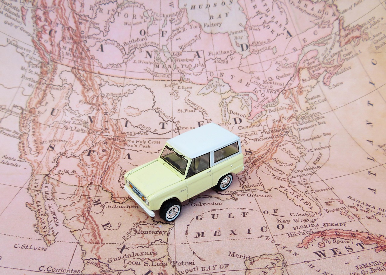
North America’s map is not only a tool for understanding borders and countries but also a reflection of its historical evolution. From indigenous territories and European colonial endeavors to modern-day nation-states, the layers of history remain visible in the current geopolitical landscape. For example, the French influence in Canada and parts of the United States contrasts with the Spanish colonial heritage in Mexico and much of Central America, while the British influence dominates in the United States and Caribbean islands like Jamaica and the Bahamas.
Historical Impact on Modern Borders and Regions
The historical context behind North America’s contemporary borders tells a story of conquest, negotiation, and cultural transformation. The arrival of Europeans in the 15th century set into motion shifts in territorial claims through exploration, colonization, and war. The Spanish, French, and British empires vied for control over vast parts of the continent, often at the expense of indigenous populations who were the original inhabitants since approximately 40,000 years ago.
Colonial competition led to exchanges of territory through treaties and conflicts, such as the British acquisition of Canada from the French after the Seven Years’ War and the complex contests between Spain and Britain over Caribbean and Central American territories. The colonial legacy still shapes the linguistic and cultural regions visible on today’s maps, with Spanish predominantly spoken in Mexico and much of Central America, French in Quebec and parts of the Caribbean, and English widely spread across the United States and Canada.
The borders drawn through these colonial eras have also influenced economic and social dynamics. For instance, the United States’ border with Mexico is one of the most intensely traversed international boundaries worldwide, generating significant discussions related to immigration, trade, and security, particularly under the influence of agreements like NAFTA and its successor, the United States-Mexico-Canada Agreement (USMCA). Similarly, the Canadian-American border is the longest undefended land border on Earth, facilitating extensive trade and cultural exchanges between the two neighbors.
This political geography also defines unique regional identities, from the industrialized Northeast United States and the expansive Great Plains to the tropical islands of the Caribbean. These divisions mirror both natural geographic features and human geopolitical decisions that continue to evolve as countries adapt to contemporary challenges like climate change, urban expansion, and international diplomacy.
The Continent’s Diverse Geography: Mountains, Plains, and Waterways
North America is marked by an astonishing range of physical features that shape its environment, economy, and settlement patterns. At its heart lies the Great Plains, an expansive region of flatlands stretching east of the Rocky Mountains and extending toward the Canadian Shield and Appalachian Mountains. This area is known for its fertile soils and widespread agriculture – often described as the continent’s “breadbasket.” The plains’ landscape, though largely treeless and smooth, includes subtle hills such as those in the Ozark Plateau and scattered sandhills in Nebraska, reflecting diverse geological formations.
The Rocky Mountains are among the continent’s most dramatic geological features, extending over 2,000 miles from northern New Mexico through Canada to Alaska’s southern region. Their towering peaks, including Mount McKinley (Denali) at 20,322 feet – the highest point in North America – define not only the physical but also climatic diversity of western regions. The Rockies influence weather patterns and provide critical ecosystems, serving as sources for important rivers and supporting tourism, winter sports, and natural resource industries.
Rivers traverse the continent with extraordinary significance. The Mississippi River system stands out as a vital artery, flowing from northern Minnesota southward to the Gulf of Mexico near New Orleans. Its extensive network, including the Missouri and Ohio rivers, collectively forms the third longest river system globally, contributing to inland transportation, water supply, and agricultural irrigation. Other key waterways like the Columbia River in the Pacific Northwest and the Mackenzie River in Canada’s Arctic regions highlight the continent’s rich freshwater resources.
Beyond rivers, North America hosts the Great Lakes, a spectacular cluster of five freshwater lakes forming the largest freshwater system on Earth when connected with the St. Lawrence River. Straddling the U.S.-Canada border, these lakes are central to trade, industry, and ecological diversity. Their shores include major cities such as Chicago, Detroit, and Toronto, underlining the interplay between natural geography and urban development.
On the eastern side, the Appalachian Mountains, extending some 1,500 miles from Alabama to Newfoundland, offer a more rolling, ancient range that has shaped settlement, natural resource use, and cultural identity. From the swamps and deltas dotting the coastline to the fertile interior valleys, these geographical features collectively define the vast and varied landscape of North America, influencing everything from agriculture and transportation to climate zones and biodiversity.
Climate Zones and Environmental Diversity Across North America
North America is distinguished by its wide array of climate zones, resulting from the continent’s vast size, elevation changes, and varying latitudes. From the frigid Arctic conditions in northern Canada and Alaska to the tropical warmth of the Caribbean and southern Mexico, the continent hosts a climate spectrum that affects human habitation, natural habitats, and economic activities.
In the northern reaches, the Arctic and subarctic climate zones dominate. These areas experience long, harsh winters with heavy snow cover and brief summers. Indigenous peoples such as the Inuit and Aleut have historically adapted to these conditions by developing unique dwellings and survival strategies. The permafrost and tundra ecosystems prevalent here are highly sensitive to climate change, which in 2026 continues to cause alarming impacts such as melting ice and shifting animal migration patterns.
Moving southward, continental climates prevail across much of the central and eastern United States, featuring distinct seasons with warm summers and cold winters. The Great Plains, in particular, experience a semi-arid climate, punctuated by occasional droughts and tornadoes. This region’s climate makes it ideal for agriculture but also vulnerable to extreme weather events.
The western side of the continent offers varied microclimates, especially influenced by mountain ranges like the Rockies and the Sierra Nevada. Coastal zones feature Mediterranean climates with wet winters and dry summers, particularly in parts of California, while the mountainous areas can have alpine conditions.
The southern United States, Mexico, and the Caribbean islands enjoy tropical and subtropical climates. These regions benefit from warm temperatures year-round but face periodic threats such as hurricanes and tropical storms. The coastal states bordering the Gulf of Mexico, for example, experience seasonal hurricanes that have significant social and economic impacts.
Environmental diversity is mirrored in flora and fauna adapted to these climate zones – from boreal forests spanning Canada to desert areas like the southwestern United States and northern Mexico. Conservation efforts in national parks and protected areas emphasize this biodiversity as a critical part of the continent’s heritage. Climate zones in North America not only influence natural ecosystems but also affect urban planning, agricultural practices, and energy needs, illustrating their central role in shaping the continent’s future.
Major Cities and Economic Centers Shaped by Geography in North America
North America’s geography has directly influenced the development of its vibrant cities and regional economies. Coastal hubs such as New York City, Toronto, and Los Angeles emerge not only as population centers but also as global economic engines with significant cultural influence. These metropolises benefit from geographic advantages like access to ports, rivers, and natural resources, fostering trade and industrial growth.
Moving inland, cities like Chicago and Minneapolis capitalize on their proximity to the Great Lakes and major rivers, enabling transportation corridors that move goods across the continent. The Mississippi River basin supports agricultural and manufacturing industries that rely on waterways for the movement of commodities ranging from grains to manufactured products.
In the western regions, urban centers like Vancouver and Seattle align closely with mountainous and coastal geographies, seizing opportunities in sectors such as forestry, technology, and maritime trade. The presence of natural landmarks such as national parks also supports tourism, which provides substantial economic benefits to many cities in the Rocky Mountain corridor.
Southern cities in Mexico, including Mexico City and Monterrey, thrive in part due to their location in resource-rich and climatically favorable areas. These cities blend rich cultural histories with modern industrial growth, contributing significantly to North America’s overall economic landscape.
The Caribbean cities, while often smaller in size, play crucial roles as tourist destinations and maritime trade points, particularly in countries like Cuba, the Dominican Republic, and the Bahamas. Their economies hinge largely on tourism, shipping, and service industries, which are deeply connected to their island geographies and climates.
North America’s urbanization patterns thus showcase how geography – from mountains and rivers to coastlines and plains – continues to shape the flow of population, capital, and innovation. The continent’s cities are hubs where cultural diversity meets economic vitality, embedding geography at the core of their growth and challenges such as urban sprawl, infrastructure needs, and environmental sustainability.
Unique Rivers, Mountains, and Natural Landmarks Defining North America
Natural features such as rivers and mountains not only sculpt the physical landscape but also serve as poignant symbols and practical resources throughout North America. Among them, the Mississippi River system stands out as a vital waterway, stretching over 2,300 miles and connecting the heartland to the Gulf of Mexico. Its tributaries – like the Missouri and Ohio rivers – extend the system’s reach to nearly 3,900 miles, making it pivotal for shipping, agriculture, and habitat diversity.
The Appalachian Mountains, with their ancient, weathered ridges, span from Alabama to Newfoundland, providing rich biodiversity and historical significance. These mountains have historically been corridors for migration and settlement and remain popular today for recreation and conservation.
Dominating the western landscape is the Rocky Mountain range. Its towering peaks, rugged terrain, and vast forests support not only ecosystems but also human activities such as mining, skiing, and hiking. Mount McKinley, or Denali, located in the Alaska Range, crowns the continent as its highest point, attracting adventurers and researchers alike.
Other notable landmarks include the Great Lakes system, which, along with the St. Lawrence River, forms the largest freshwater network globally. This system is essential for transportation, freshwater supply, and ecological health. It also demarcates much of the U.S.-Canada border and supports some of the continent’s largest urban areas.
Additional geographic wonders like Death Valley in California – the lowest point in North America at 282 feet below sea level – demonstrate the continent’s extremes. The fertile valleys such as the Sacramento and San Joaquin in California contrast these extremes by offering some of the most productive agricultural zones.
These rivers, mountains, and landmarks continue to influence the continent’s climate, economy, and culture. For instance, river valleys often support indigenous and settler communities dating back thousands of years, with archaeological sites showcasing this rich heritage. Today, these features also play central roles in environmental management and outdoor recreation, cementing their position as defining characteristics of the North American continent.