
Geopolitical Landscape and Country Borders of the Middle East Map
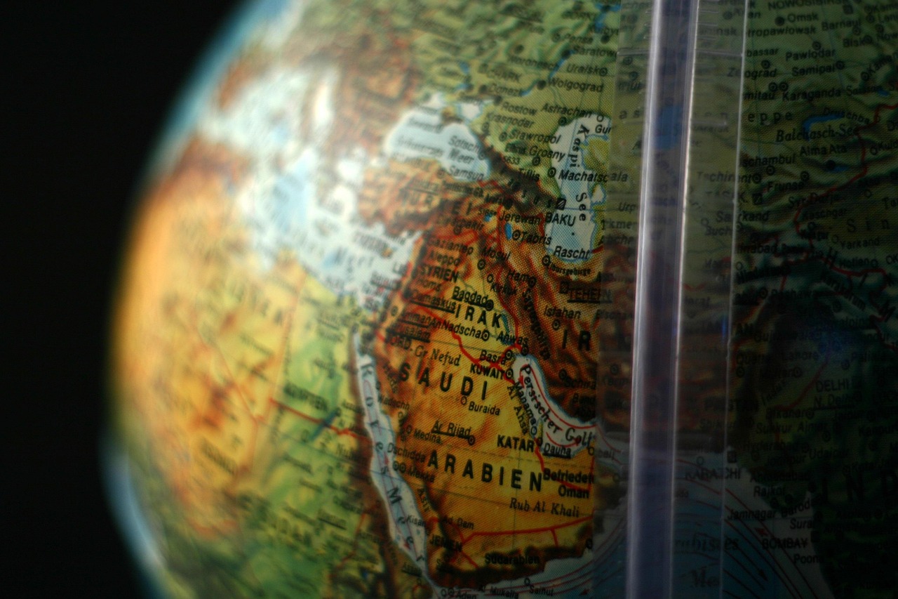
The Middle East is often perceived as a complex and dynamic region, rich in history and geopolitical significance. To better comprehend the structure of this region, one must first examine a detailed Middle East map highlighting the countries and their respective borders. The region generally encompasses the Arabian Peninsula and the lands bordering the easternmost parts of the Mediterranean Sea, the northernmost part of the Red Sea, and the Persian Gulf. Notable countries within this definition include Bahrain, Cyprus, Egypt, Iran, Iraq, Israel, Jordan, Kuwait, Lebanon, Oman, Qatar, Saudi Arabia, Syria, Turkey, United Arab Emirates, and Yemen.
Each country in the Middle East exhibits borders shaped not only by geography but also by decades of political history and conflict. For example, Turkey’s borders in the northwest mark the boundary between Europe and Asia, making it a critical land bridge within the region. Saudi Arabia, one of the largest countries geographically in the Middle East, occupies most of the Arabian Peninsula, with neighboring states like Yemen to the south and Kuwait to the northeast. These boundaries hold more than just territorial importance – they can also signify ethnic divisions, religious landmarks, and resource-rich areas.
The history behind these borders is essential for understanding contemporary politics. The boundaries were heavily influenced by colonial powers in the twentieth century, particularly after the dissolution of the Ottoman Empire. The Sykes-Picot Agreement of 1916, for example, divided much of the Middle East between British and French influences, leaving lasting impacts on national borders that still exist today. This colonial legacy often complicates diplomatic relations and territorial disputes, as some borders do not fully reflect the cultural or ethnic distributions on the ground.
Moreover, the political map of the Middle East frequently changes due to ongoing conflicts and alliances. Countries like Syria and Yemen have experienced civil unrest, leading to shifts in control of border areas over the years. Such dynamic changes affect not only diplomatic ties but also the movement of people and goods across borders. International agreements and organizations continuously monitor and adjust to these evolving realities, making updated maps an indispensable tool for policymakers and analysts.
The Middle East map is also a vital educational resource. Institutions like the CIA Factbook produce detailed and authoritative maps based on geopolitical standards aligned with U.S. government policies. However, it should be noted that such representations may differ from those preferred by other countries or groups within the region, underlining the inherent political sensitivities surrounding territorial claims.
Understanding country borders through these maps does not only facilitate geographic literacy but also deepens awareness of the security challenges, cultural interactions, and economic corridors within the Middle East. For example, the placement of smaller nations such as Bahrain and Qatar along vital maritime routes underscores their strategic importance in global trade and energy markets. As the Middle East continues to play a pivotal role on the international stage, the detailed geographic knowledge provided by maps remains crucial for navigating the complexities of this region.
The significance of borders extends even to humanitarian concerns. Refugee flows and migration patterns within the region often hinge on border permeability and political relationships. Thus, each delineation on a Middle East map carries deep implications for governance, stability, and development. In 2026, as regional dynamics evolve with shifting alliances and economic transformations, keeping abreast of these geographic details through accurate and updated maps is more important than ever.
Topography and Climate: Defining the Physical Geography of the Middle East
The physical geography of the Middle East is as diverse as it is dramatic, with distinct topographical features shaping the climate, lifestyle, and settlement patterns of its inhabitants. When examining a Middle East map with a focus on topography, one immediately notices mountain ranges, vast deserts, fertile river valleys, and expansive coastal plains, each playing a critical role in the ecological and human geography of the region.
One of the most influential topographical features is the Arabian Desert, spanning a large part of the Arabian Peninsula. This desert includes the renowned Rub’ al Khali or “Empty Quarter,” the largest uninterrupted sand desert in the world. The harsh arid climate here limits human settlement, shaping the nomadic cultures that historically traversed these terrains. In contrast, the fertile floodplains of the Tigris and Euphrates rivers in Iraq have supported some of the world’s earliest civilizations, making their presence vital on any comprehensive geography map of the Middle East.
The mountain ranges of the Middle East also dramatically influence local climate and vegetation. For example, the Zagros Mountains in Iran run parallel to the Persian Gulf and create a rain shadow effect, leading to much drier conditions on the leeward side. Similarly, the Taurus Mountains in southern Turkey act as a natural barrier between the Mediterranean coast and the Anatolian plateau, influencing agricultural zones and settlement distributions.
Climate in the Middle East varies widely due to these topographical intricacies. Coastal areas along the Mediterranean Sea experience a Mediterranean climate characterized by hot, dry summers and cool, wet winters. Cities such as Beirut and Istanbul enjoy moderate temperatures with adequate rainfall fostering lush vegetation. Meanwhile, inland and southern parts of countries like Saudi Arabia and Oman have arid desert climates with extreme temperatures and minimal precipitation. This vast climatic diversity is a crucial factor in how populations distribute themselves, their economic activities, and their cultural traditions.
The oasis scattered throughout deserts serve as vital hubs of life, where water is accessible and agriculture blossoms despite the surrounding dry conditions. Dates, olives, and citrus fruits thrive in these areas, sustaining local economies and contributing to cultural landmarks that have persisted for centuries. The unique interplay between geography and climate in these oases exemplifies human adaptation to an otherwise challenging environment.
Furthermore, the topographical and climatic variations have implications for natural disaster vulnerabilities. Earthquake activity, particularly in the eastern Mediterranean and Iran’s mountainous regions, poses risks to densely populated urban centers. Seasonal flash floods can affect arid regions suddenly, especially during rare but intense rainfall. Thus, understanding the physical geography of the Middle East is critical not only for natural resource management but also for disaster preparedness and urban planning.
As of 2026, climate change impacts are becoming increasingly evident across the Middle East, exacerbating water scarcity and intensifying heatwaves, particularly in desert regions. This evolving climate condition challenges traditional ways of life and demands innovative solutions in water management and sustainable agriculture. Examining a Middle East map that integrates topographical and climate data provides valuable insights into both the current state and future trajectory of this essential region.
Natural Resources of the Middle East: Strategic Wealth and Economic Impact
One of the most defining characteristics of the Middle East on any map is its extraordinary richness in natural resources, particularly oil and natural gas. These resources have made the region a critical player in the global economy and geopolitics. The distribution of these resources can be visually traced on maps that mark key fields, pipelines, and reserves, helping to explain the economic landscape and international interests.
Oil production is famously abundant in countries such as Saudi Arabia, Iraq, Iran, Kuwait, and the United Arab Emirates. Saudi Arabia, in particular, boasts some of the largest proven oil reserves in the world, accounting for a substantial share of global exports. The presence of these resources has shaped the economies of these nations, fostering rapid urbanization, wealth generation, and regional influence. The Persian Gulf, bordered by many oil-rich states, is especially noted for its critical shipping lanes that transport vast quantities of petroleum worldwide.
Natural gas is another vital resource concentrated in several Middle Eastern countries. Iran and Qatar possess some of the world’s largest conventional natural gas reserves, contributing to their energy exports and regional partnerships. These resources fuel domestic industries, electricity generation, and petrochemical production, while also serving as leverage for diplomatic negotiations and trade agreements.
Beyond hydrocarbons, the Middle East is endowed with other natural riches including minerals like phosphates, sulfur, and various metals. For instance, Morocco’s phosphate deposits are among the largest globally, essential for fertilizer production and agriculture. The diversity of resources means that many Middle Eastern economies are gradually attempting to diversify beyond oil dependence, investing in mining, renewable energy, and technology sectors.
Water resources, though scarce, also hold enormous strategic value in the region. Rivers like the Nile in Egypt and the Jordan River in Israel and Jordan are lifelines for millions. Maps depicting river basins and aquifers highlight the fragile balance between demand and availability. These water sources are focal points of cooperation and occasional conflict, reflecting the critical role that sustainable resource management plays in regional stability.
The natural resource wealth has profoundly shaped international relations. Control over energy reserves has led to complex alliances and rivalries, influencing diplomacy and sometimes conflicts. The 2020s have also seen increased attention to renewable energy investments within some Middle Eastern states, aiming to mitigate climate change risks and future-proof their economies. For example, solar energy projects in Saudi Arabia and the UAE are part of ambitious economic transformation plans, showcasing a pivot toward sustainable development while still leveraging geographical advantages.
Analyzing the Middle East map reveals how natural resources are not uniformly distributed but clustered in strategic areas. This uneven distribution influences population densities, infrastructure development, and the geopolitical significance of certain regions. By 2026, the interplay between resource abundance and technological innovation will continue to dictate the region’s domestic policies and international partnerships, underscoring the importance of geographic awareness in understanding Middle East affairs.
Cultural Landmarks and Historical Geography Reflected in the Middle East Map
The Middle East is a cradle of civilization whose cultural landmarks are etched into the fabric of its geography. Any map of the Middle East serves not only as a guide to physical terrain and political boundaries but also as a portal into a region steeped in history, religion, and cultural heritage.
From the ancient pyramids of Egypt to the historic old city of Jerusalem, cultural landmarks anchor the Middle East’s identity. These sites are often situated near major rivers or along historical trade routes, enriching their significance geographically and historically. For instance, the Nile River’s fertile banks supported ancient Egypt’s monumental architecture, while cities like Petra in Jordan evoke the legacy of the Nabateans, who masterfully adapted to the arid desert surroundings.
Religious landmarks hold profound importance on the Middle East map. Jerusalem, revered by Judaism, Christianity, and Islam, stands as a vibrant intersection of faiths and cultures. Mecca and Medina in Saudi Arabia, as pivotal Islamic holy cities, attract millions of pilgrims annually and symbolize spiritual geography that transcends political borders. These landmarks contribute to the cultural richness and sometimes to geopolitical complexities within the region.
The Silk Road and other historic trade routes are another cultural-geographic element that shaped the Middle East. Trade connected Mediterranean ports with inland cities, forging an intercultural exchange framework that influenced art, language, cuisine, and customs. Modern transportation networks often trace these ancient pathways, underscoring the enduring role of geographic corridors in shaping cultural and economic life.
Further, urban centers such as Istanbul in Turkey illustrate a blend of geographical strategic importance and rich culture. Straddling two continents, Istanbul has served as a capital for empires and a bridge of cultural exchange between East and West. Its geography as a coastal city on the Bosporus Strait enriched its historical development, visible on any detailed regional map.
Preserving these cultural landmarks is essential not only for heritage but also for tourism, educating visitors about the region’s layered history. Many countries in the Middle East are investing in safeguarding archaeological sites and promoting cultural tourism as part of their economic diversification efforts. Visualizing these landmarks on maps helps contextualize the significance of places beyond mere political boundaries, thus fostering deeper appreciation and understanding.
By illustrating connections between geography and culture, Middle East maps become more than navigation tools. They invite exploration of the stories, traditions, and histories that shape the lives of millions. This multidimensional perspective aids scholars, travelers, and policy experts alike in appreciating the complexity of the region.
Modern Challenges in Middle East Geography: Climate, Borders, and Economic Shifts
The geography of the Middle East is constantly in flux due to modern challenges ranging from climate change to economic transitions and shifting border dynamics. Understanding these challenges requires a holistic view that integrates the physical geography with the socio-political realities faced by each country on the map.
Climate change has intensified already extreme conditions in many parts of the Middle East. Regions traditionally marked by arid landscapes now frequently experience prolonged droughts, diminishing water supplies critical to agriculture and human consumption. This environmental stress stokes tensions between neighboring states over shared water resources like the Euphrates, Jordan, and Tigris rivers. The environmental geography thus directly affects political stability and humanitarian conditions.
Borders remain a sensitive issue in the Middle East. Political maps from 2026 continue to reflect unresolved disputes and contested areas, such as in Syria, Iraq, and the Israeli-Palestinian territories. International bodies and neighboring countries often engage in mediation to prevent border conflicts, but fluctuating control over certain zones keeps the geographic landscape volatile. Infrastructure projects like pipelines, railways, and roads occasionally encounter difficulties due to these uncertainties, affecting regional economic integration.
Economically, Middle Eastern countries face the challenge of transforming their dependency on oil exports. Diversification efforts are geographically shaped, with some countries exploiting their coastal advantages to become logistics and financial hubs, while others invest in renewable energy or technology parks in desert areas with abundant sunlight. For example, Dubai and Abu Dhabi leverage their geographic locations on the peninsula to become global business centers, with sprawling ports and international airports connecting continents.
Urbanization trends add another layer to this complexity. The rapid growth of megacities like Cairo, Tehran, and Istanbul places pressure on infrastructure, housing, and natural resources. Managing urban sprawl and ensuring sustainable development are pivotal concerns linked intricately to geographic planning and environmental management. Zones designated as green spaces and natural reserves attempt to balance urban expansion with ecological preservation.
Finally, geopolitical developments such as new regional alliances or shifts in trade routes continue to redefine the Middle East’s geographic importance. The region remains a crucial transit zone for energy and commerce between Asia, Africa, and Europe. Strategic waterways like the Suez Canal and Bab el-Mandeb Strait on any Middle East map are lifelines for global maritime traffic, making their security paramount for international markets and political stability.
Recognizing these ongoing geographic challenges encourages adaptive strategies that consider both natural and human factors. By regularly updating and analyzing Middle East maps, planners and decision-makers gain valuable perspectives on how best to navigate the region’s evolving realities while promoting cooperation and sustainable growth in the years ahead.