Understanding the Andes Mountains: South America’s Majestic Backbone
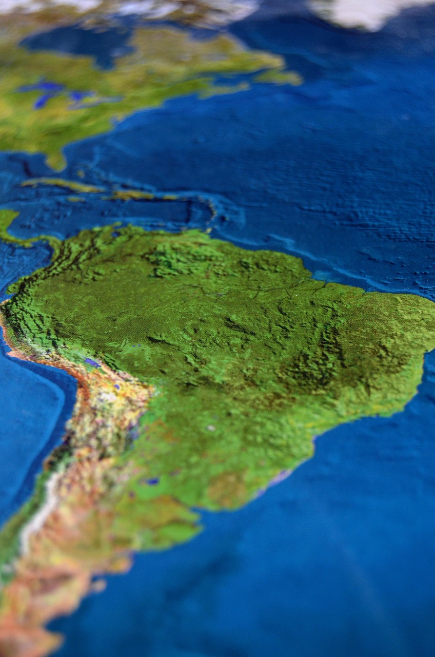
The Andes Mountains extend as the world’s longest continental mountain range, stretching approximately 7,000 kilometers from Venezuela in the north through Colombia, Ecuador, Peru, Bolivia, Chile, and Argentina in the south. This vast and rugged range fundamentally shapes South America’s physical geography. It towers along the continent’s western edge, creating a natural spine that influences climate, ecosystems, and human settlement patterns.
One notable characteristic of the Andes is their diversity of climatic zones, which are largely dictated by variations in altitude and latitude. In the northern Andes, the climate can be tropical, with the dense cloud forests coexisting with high-altitude paramo ecosystems. As the mountain chain moves southward, near Patagonia, glaciers and icy peaks dominate the landscape, reflecting colder alpine conditions. For example, Aconcagua in Argentina stands as the highest peak in the Americas at 6,960 meters, attracting climbers worldwide drawn by both the challenge and breathtaking views.
The Andes have also played a pivotal role in shaping the cultural and economic histories of South America. The range served as the cradle for pre-Columbian civilizations such as the Inca Empire, whose agricultural terraces ingeniously adapted to steep mountainsides remain visible today. The highland zones, including the Altiplano plateau shared between Bolivia and Peru, host the world’s highest large cities, such as La Paz and Quito, demonstrating human adaptation to extreme environments.
Geologically, the Andes are considered young and seismically active, continually shaped by the tectonic collision of the Nazca and South American plates. This geological activity is responsible for the abundant mineral wealth found throughout the range. Countries like Chile and Peru rank among the world’s leaders in copper production, providing critical resources to global markets. Lithium, essential for modern battery technology, is extensively mined in the high salt flats scattered across the Andes’ plateau regions.
Beyond their physical and economic importance, the Andes influence regional climate patterns in South America by acting as a towering barrier. They affect the distribution of rainfall, creating moist conditions on the windward western slopes, which sustain rich forest ecosystems, while casting rain shadows that contribute to arid zones like the Atacama Desert just to their west.
For adventurers, the Andes remain a magnet for activities spanning trekking, scientific research, and natural exploration. The mountain environments support unique biodiversity, including species adapted to high elevations and varied microclimates. In 2026, multidisciplinary studies continue to reveal the Andes’ crucial role in the continent’s water cycle, climate regulation, and cultural heritage preservation, confirming their status as South America’s geographical backbone.
The Vast Amazon Basin and Its Environmental Significance in South America
Encompassing roughly seven million square kilometers, the Amazon Basin is the largest drainage basin in the world, dominating northern South America and touching nine countries with Brazil at its core. This vast region includes the Amazon Rainforest, the most expansive tropical forest on Earth, recognized for unparalleled biodiversity and substantial global ecological impact.
Climatically, the basin is characterized by hot and humid conditions with consistently abundant rainfall, nurturing its evergreen canopy and supporting millions of plant and animal species, many of which are endemic. This biodiversity hotspot acts as a vital regulator of the global climate system through its carbon sequestration capabilities, earning its nickname as the “lungs of the planet.” The Amazon River itself, stretching approximately 6,400 kilometers, is the second longest in the world and discharges more freshwater into the Atlantic Ocean than any other river, exemplifying the basin’s hydrological magnitude.
Human presence in the Amazon basin is a complex interplay of Indigenous communities and modern society. Indigenous tribes maintain ancestral knowledge and sustainable living practices intimately tied to their natural environment, highlighting South America’s deep cultural connection to geography. However, expanding agricultural frontiers, logging, and mining operations present ongoing threats to the forest. As of 2026, international efforts, including collaboration under the Amazon Cooperation Treaty Organization, focus on implementing conservation initiatives and balancing economic development with ecological preservation.
Scientific expeditions in recent years have unveiled new species regularly, illustrating the ecosystem’s richness and fragility. Innovations in satellite mapping have enhanced monitoring efforts to detect deforestation and promote reforestation strategies. Additionally, the basin’s waterways remain vital transportation routes, supporting both local livelihoods and regional trade.
The Amazon’s climatic influence extends beyond its borders, affecting precipitation patterns across tropical South America and even interacting with the South American Monsoon System. The moisture transported by river systems and forests contributes to rainfall in agricultural regions thousands of kilometers away, underscoring the interconnectedness of South America’s geography and climate.
With heightened global awareness of climate change challenges, the Amazon Basin represents both a critical resource and a vulnerable ecosystem. It serves as a vital reminder of how South America’s geography is central not only to local communities but to worldwide environmental health and sustainability goals.
South America’s Intriguing Arid Landscapes: The Atacama Desert’s Geography and Economy
One of the driest places on Earth, the Atacama Desert stretches across northern Chile’s Pacific coast, covering an expanse of about 105,000 square kilometers. Its arid conditions result from a combination of geographic and climatic factors, including the Andes Mountains’ rain shadow effect and persistent cold currents from the Pacific Ocean, which suppress cloud formation and precipitation.
This desert’s unique geography has given rise to striking landscapes featuring salt flats, rugged volcanic terrain, and sand dunes. Despite its harsh climate, the Atacama is a hotspot for mineral wealth and technological advancement. Its soil holds extensive reserves of copper and lithium, resources integral to global industries such as electronics and renewable energy. In 2026, Chile’s mining sector remains a powerhouse, extracting these minerals while striving to implement environmentally responsible practices to mitigate ecosystem disruption.
Apart from economics, the Atacama Desert is significant for scientific research. Its clear skies, minimal atmospheric moisture, and low light pollution create ideal conditions for astronomical observatories. Facilities like the ALMA Observatory attract scientists worldwide to study cosmic phenomena, advancing astrophysics and space science.
Ecologically, the desert sustains a variety of specially adapted flora and fauna. Small plant species have evolved mechanisms to survive with scarce water availability, while some animals navigate the extreme environment through nocturnal habits and physiological adaptations.
The challenge remains balancing economic interests with environmental sustainability. Recent initiatives have focused on water conservation technologies in mining processes, promoting renewable energy usage, and protecting unique habitats. These efforts reflect a growing recognition in South America of the need to harmonize human activities with the delicate geography of arid regions.
Understanding the Atacama’s geography fosters appreciation for the resilience of nature and human ingenuity in exploiting and preserving such a demanding environment. The desert exemplifies South America’s contrasting geographic extremes – from lush rainforests to arid landscapes – and highlights the continent’s diverse natural heritage.
Exploring the Fertile Pampas: South America’s Agricultural Heartland
Stretching across parts of Argentina, Uruguay, and southern Brazil, the Pampas region covers roughly 750,000 square kilometers and is recognized as one of the most productive agricultural zones in the world. Its flat, grass-covered plains boast some of the richest and most fertile soils, making this region vital for crop cultivation and livestock grazing.
The Pampas have shaped South America’s socio-economic landscape for centuries. Historically, this vast grassland supported a ranching culture with traditional gauchos known for cattle herding and horsemanship, a heritage that still influences regional identity and cuisine. The fertile lands produce staples like wheat, corn, and soybeans at large scales, feeding not only local populations but also contributing heavily to global food markets.
Modern agricultural techniques continue to enhance productivity, integrating mechanized farming, crop rotation, and soil conservation practices to combat issues such as erosion and nutrient depletion. These sustainable approaches are critical in preserving the Pampas’ long-term viability amid concerns about climate variability and land use changes.
The region also benefits from its network of rivers, including parts of the Paraná and Uruguay river systems, which provide essential irrigation resources and transportation routes for agricultural exports. Hydroelectric projects harness water from these river systems, supporting the energy needs of nearby urban centers and industries.
Urban areas adjacent to the Pampas, such as Buenos Aires and Montevideo, act as economic hubs where agricultural products are processed and distributed. The interplay between rural and urban spheres highlights how South America’s geography facilitates integration across sectors.
In 2026, the Pampas continue to evolve with technological advancements in agri-business and precision farming. These developments enable farmers to optimize yields while reducing environmental footprints, exemplifying how geography and innovation converge to sustain one of the continent’s most vital natural assets.
South America’s River Systems: Lifelines of Geography, Culture, and Economy
Rivers are arguably South America’s most defining geographic features, shaping landscapes while nourishing populations and ecosystems alike. The continent boasts some of the world’s grandest river systems, including the Amazon, Paraná, Orinoco, and Magdalena rivers, each playing a crucial role in regional ecology, transportation, and economic activities.
The Amazon River dominates the continent’s hydrology. Draining the largest tropical rainforest, its basin covers millions of square kilometers. The river’s extraordinary volume supports incredible biodiversity and sustains many indigenous communities who rely on its waters for transportation, food, and cultural practices. Its tributaries crisscross dense forest landscapes, providing natural corridors for wildlife and facilitating scientific exploration.
The Paraná River is central to the southern portion of the continent, flowing through Brazil, Paraguay, and Argentina. It forms part of the extensive La Plata Basin, supporting agricultural irrigation, hydroelectric dams like Itaipu – the world’s second-largest hydroelectric facility – and vital shipping routes for goods and commodities. This river system underpins economic development by connecting interior regions to Atlantic ports.
Similarly, the Orinoco River traverses Venezuela and Colombia, supporting diverse ecosystems ranging from tropical rainforests to savannas. It forms part of a natural waterway linked to the Amazon via the Casiquiare canal, one of the world’s few natural river bifurcations, illustrating the intricate hydrological interconnectivity of South America’s landscapes.
Smaller but significant rivers such as the Magdalena in Colombia play key roles in supporting densely populated regions with transport routes and agriculture. They also face challenges like pollution and sedimentation, prompting calls for concerted water management and environmental conservation efforts.
Overall, South America’s rivers function as critical arteries intertwining natural systems with human activity. They have historically facilitated exploration, sustained indigenous civilizations, and currently support some of the continent’s most important economic sectors. The management and preservation of these waterways remain essential for the continent’s sustainable future, as their health is directly linked to biodiversity, food security, and climate resilience.