
Oceania is the hardest region to read on a world map. Most of it is water. The land adds up to a small share of the surface it covers, and the standard projections stretch the Pacific until the islands look like printing errors.
The region follows a clear order once you know where to look. It splits into four parts: Australasia, Melanesia, Micronesia and Polynesia. Get those four straight and the rest of the map falls into place.
What Oceania covers
Oceania groups Australia, New Zealand, New Guinea and the island groups of the central and southern Pacific. It holds 14 sovereign states, plus a long list of territories attached to France, the United States, New Zealand, the United Kingdom and Chile.
The 14 independent countries are Australia, New Zealand, Papua New Guinea, Fiji, Solomon Islands, Vanuatu, Samoa, Tonga, Kiribati, the Marshall Islands, the Federated States of Micronesia, Nauru, Palau and Tuvalu.
The interesting number is the sea, not the land. Several of these states control maritime zones larger than most European countries while holding a land area you could walk across in a morning. Kiribati spreads its islands across all four hemispheres. Its exclusive economic zone runs to millions of square kilometres.
Australasia: the continental anchor
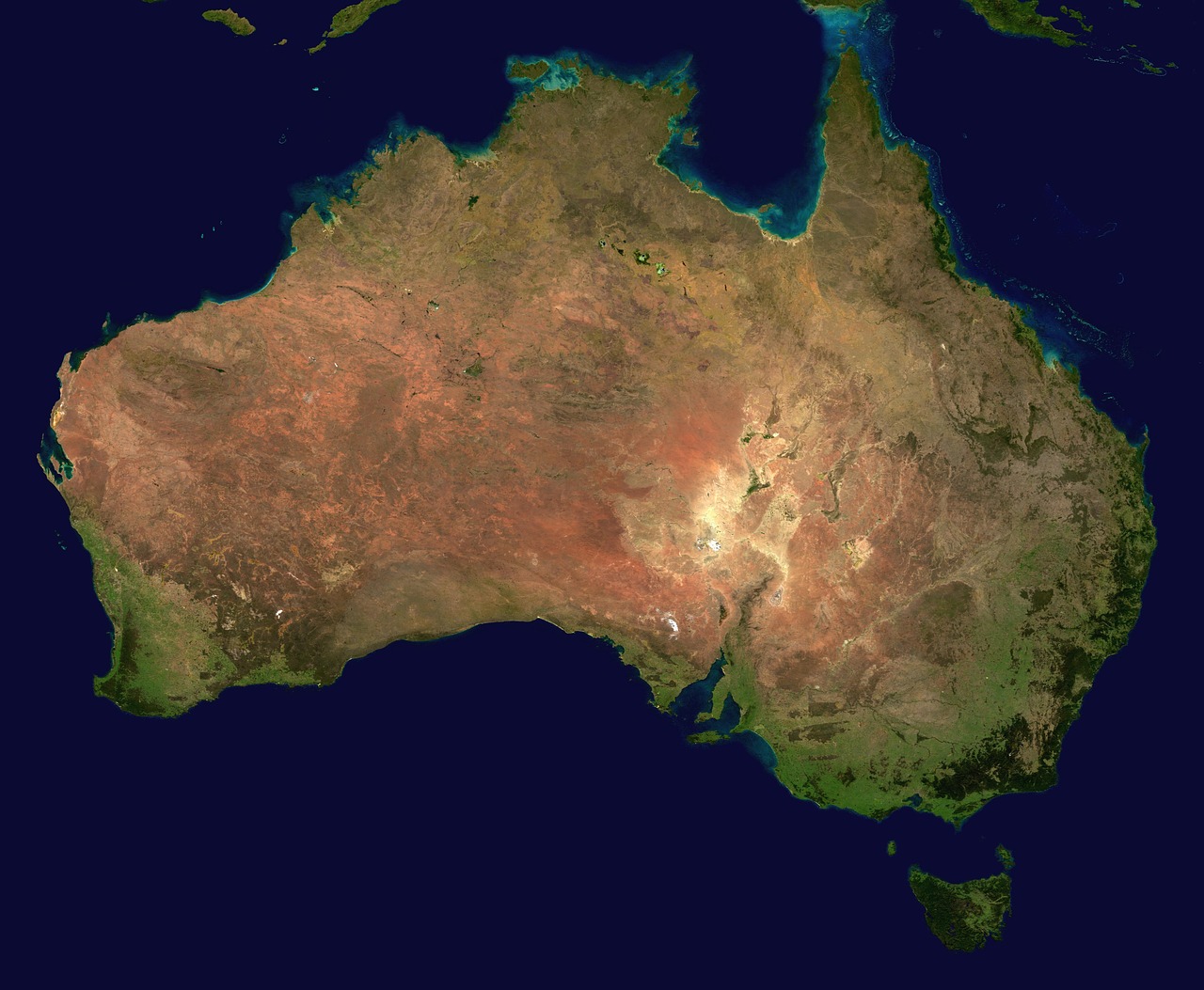
Australasia holds Australia, New Zealand and the neighbouring islands. It is the part of Oceania that behaves like a continent rather than an archipelago.
- Australia is a single landmass of ancient, eroded rock. Its highest point, Mount Kosciuszko, reaches about 2,228 metres, low for a continent. The interior is arid, and the population sits on the coastal fringe.
- New Zealand sits on the boundary between the Pacific and Australian plates. That collision built the Southern Alps, and it keeps building them. Aoraki, or Mount Cook, stands at roughly 3,724 metres.
The two look close on a map. They sit around 2,000 kilometres apart across the Tasman Sea, which is roughly the distance from Paris to Moscow.
Melanesia: the volcanic arc
Melanesia runs northeast of Australia: Papua New Guinea, Solomon Islands, Vanuatu, Fiji and New Caledonia. This is the mountainous, forested part of Oceania.
New Guinea is the second largest island on the planet after Greenland, and it carries a mountain spine that stays high enough for glaciers close to the equator. Puncak Jaya, on the Indonesian side of the island, rises to about 4,884 metres and counts as the highest point in the region depending on where you draw the boundary between Oceania and Asia. Mount Wilhelm, in Papua New Guinea, reaches about 4,509 metres.
Melanesia also holds the densest concentration of languages anywhere. Papua New Guinea alone counts several hundred living languages, a direct consequence of valleys that isolated communities for thousands of years.
Micronesia: small islands, vast distances
Micronesia sits north of Melanesia and east of the Philippines. Palau, the Federated States of Micronesia, the Marshall Islands, Nauru, Kiribati and Guam make up most of it.
The islands here are small. Many are coral atolls that sit a couple of metres above sea level, built on the rims of sunken volcanoes. That geometry has two consequences:
- Fresh water is scarce. An atoll holds a thin lens of rainwater floating on salt water. Overdraw it and the well turns brackish.
- Sea level matters more here than anywhere. A rise measured in centimetres reshapes the coastline and the aquifer at the same time.
The Mariana Trench runs along the eastern edge of this group. It holds the deepest known point in any ocean.
Polynesia: the great triangle
Polynesia is the largest of the four by area and the emptiest. Draw a triangle with corners at Hawaii, New Zealand and Easter Island and you have it. Samoa, Tonga, Tuvalu, the Cook Islands, French Polynesia and Tokelau sit inside.
The distances are the point. Polynesian navigators crossed thousands of kilometres of open ocean using star paths, swell patterns and bird behaviour, and they settled almost every habitable island in the triangle before European ships arrived. That single fact explains why languages from Hawaii to New Zealand still share recognisable vocabulary.
Two lines that cut through the map
Two geographic conventions cross Oceania and both cause confusion.
- The equator runs through Kiribati and the Micronesian states, which puts parts of Oceania in the northern hemisphere.
- The International Date Line zigzags around island groups so that each country keeps a single calendar day. Kiribati pushed the line east so its whole territory shares one date, which is why it greets each new year before anywhere else.
Geology sets the tourism map
Islands in Oceania come in two kinds, and the difference decides what you find when you land.
- High volcanic islands. Steep interiors, rivers, waterfalls, rainforest and dark sand. Think Tahiti, Upolu, Viti Levu.
- Low coral atolls. Flat, ringed lagoons, white sand, no rivers and thin soil. Think the Marshall Islands, Tuvalu, much of Kiribati.
Some islands are both, a volcanic core with a coral collar, caught mid-way through the slow subsidence that turns one into the other.
Reading the region on a flat map
Three habits fix the usual mistakes:
- Distrust the projection. On a Mercator map the Pacific looks like a gap between continents. It covers about a third of the planet.
- Look at sea territory, not land area. The political weight of these states comes from their exclusive economic zones.
- Follow the plate boundaries. The Ring of Fire explains the volcanoes, the earthquakes and the trenches in one line.
The same logic works for every region. If you want the neighbouring pieces, the East Asian map is at https://www.theglobaleyes.com/east-asia-map/, and this guide covers Southeast Asia, where the archipelagos start to look like Melanesia. For the far side of the Pacific, theglobaleyes.com/map-north-america-features takes the same approach.