Antarctica has a landmass under its ice. The Arctic does not. At the top of the world sits an ocean, frozen over for most of the year, ringed by the territory of eight nations. The map looks deceptively simple until you notice how much of it is a question mark.
An ocean, not a continent
The Arctic Ocean covers roughly 14 million square kilometres, comparable in area to Antarctica, but the comparison stops there. Where the southern continent sits on rock, the Arctic is seawater topped with ice that thickens in winter and retreats in summer. There is no bedrock to map, only ice that moves, cracks and reforms from one season to the next.
Sea ice extent has become the defining measurement of the region. Summer minimum ice cover has declined sharply since satellite records began in the late 1970s, and the shrinking edge of the ice is redrawing the practical map of the Arctic year on year, even if the ocean beneath stays the same shape.
Eight countries touch the Arctic
Unlike Antarctica, where sovereignty is suspended by treaty, Arctic territory is settled and inhabited. Eight states have land within the Arctic Circle or a recognised Arctic coastline: Canada, Denmark through Greenland, Finland, Iceland, Norway, Russia, Sweden and the United States through Alaska.
Russia holds by far the longest Arctic coastline, and its northern territory extends across eleven time zones from the Kola Peninsula to the Bering Strait. Canada’s Arctic archipelago, a maze of islands separated by channels that ice locks shut most of the year, makes up the other major landmass in the region.
The seabed nobody has finished dividing
Coastal states hold rights over an exclusive economic zone extending 200 nautical miles from shore, a rule that applies in the Arctic as everywhere else. What makes the Arctic different is the Lomonosov Ridge, an underwater mountain range crossing near the North Pole that Russia, Canada and Denmark have each argued is a natural extension of their own continental shelf.
- A shelf claim extending beyond 200 nautical miles has to be submitted to a UN commission with geological evidence, a process that can run for years without a binding outcome.
- Russia planted a titanium flag on the seabed at the North Pole in 2007, a symbolic act with no legal weight under the framework all three countries operate within.
- The overlapping claims sit in international waters until resolved, which has not stopped exploration and mapping expeditions from all three nations in the meantime.
The Northwest Passage and the Northern Sea Route
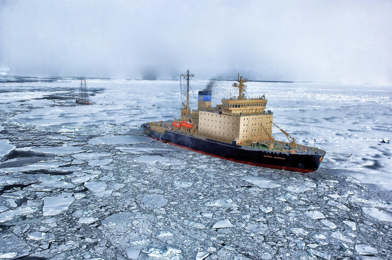
Two shipping corridors run through Arctic waters, and both have shifted from theoretical to increasingly navigable as sea ice retreats.
- The Northwest Passage threads through the Canadian Arctic archipelago, connecting the Atlantic to the Pacific along a route explorers spent centuries searching for and dying trying to complete. Canada considers these waters internal; other states, including the United States, treat them as an international strait open to transit. The dispute remains unresolved and mostly theoretical while ice still limits regular commercial traffic most years.
- The Northern Sea Route runs along Russia’s Arctic coast and carries far more commercial traffic than the Canadian route, since Russia has invested heavily in icebreaker escort and port infrastructure along it. It cuts the sailing distance between Europe and East Asia significantly compared with the Suez Canal route.
Neither route is ice-free year round. Both require ice-class vessels or icebreaker escort for most of the shipping season, and both close again in winter as the ice reforms.
Who lives on this map
Roughly four million people live within the Arctic region, a population spread thin across a vast area and concentrated in coastal towns and a handful of larger cities such as Murmansk in Russia and Tromsø in Norway. Indigenous peoples, including the Inuit across Canada, Greenland and Alaska, the Sámi across northern Scandinavia and Russia, and numerous other groups across Siberia, have lived in the region for thousands of years and hold recognised land and governance rights that vary by country.
The Arctic Council, formed in 1996, brings the eight Arctic states together with indigenous organisations as permanent participants, making decisions on environmental protection, search and rescue, and scientific cooperation. It has no authority over territorial disputes, which stay outside its mandate by design.
Where the Arctic meets the maps you already know
Several regional guides on this site touch the edge of the Arctic without making it their subject. The far north of Scandinavia and northern Europe both cross into Arctic territory, and the polar opposite of this map, Antarctica, makes the clearest comparison: one pole with a continent under permanent ice and a suspended treaty, the other an ocean, settled and divided among eight nations, that is now opening up as the ice retreats.
What the map cannot show
A static map of the Arctic understates how much the region changes. The ice edge in September looks nothing like the ice edge in March, shipping routes open and close with the season, and the seabed claims that would settle sovereignty near the North Pole remain pending. Any map of the Arctic is a snapshot of a region still being negotiated, on paper and by the climate itself.